


A HIGH WIND WATCH has been issued for the Rocky Mountain Front and parts of the Hi-Line from Wednesday night until the end of the day Thursday
——————————————————————————————————————————
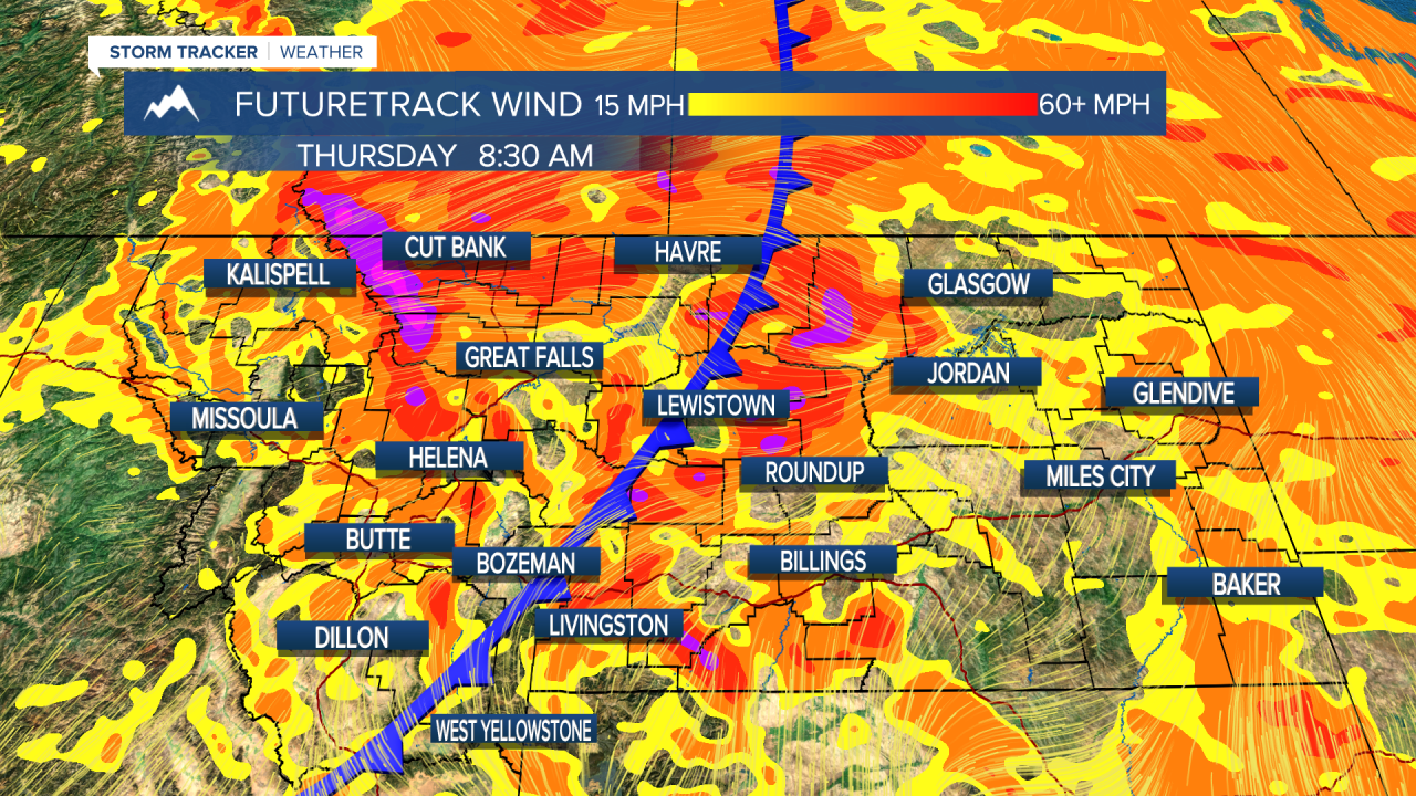
The wind will pick back up starting Wednesday and last through the rest of the work week. A cold front makes its way into northwest Montana on Wednesday afternoon to produce some light rain showers. Those showers will diminish by Thursday morning but once the front crosses the continental divide, the wind will increase out of the west. Gusts of over 60 MPH are possible.
Highs will be in the low to mid-80s across the state today. The wind will remain on the weaker side for the remainder of the day. This will be the nicest overall day we will have all week. Sunny to mostly sunny conditions will dominate the state through the end of the week.
Tomorrow will likely be the hottest day of the fall. The eastern plains will be in the low to mid-90s. Western Montana will be in the mid to upper 80s.

We cool off behind the frontal passage, but we will remain a few degrees warmer than normal through Saturday.
The rain and cooler temperatures to begin next week are still up in the air as long-range models are having a tough time agreeing on an outcome. But, overall, it is looking cooler and wetter than this week.
Helena Temperature Records Today:
High: 91 (2014)
Low: 6 (1926)
AVG: 70/42
Great Falls Temperature Records Today:
High: 93 (2009)
Low: 10 (1926)
AVG: 68/41
Have a great Tuesday!
Joey Biancone
Meteorologist
Facebook: Meteorologist Joey Biancone
Instagram: joeybianconewx
Email: joey.biancone@ktvh.com
