A Flood Advisory continues for Belt Creek through 9 PM Tonight.
——————————————————————————————————————————
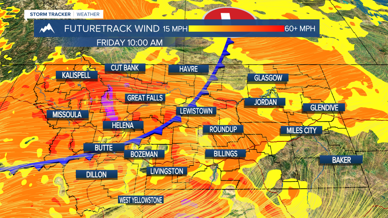
Wind across the state will start to increase today ahead of the arrival of a cold front on Friday. Strong gusts of over 50 mph are possible on starting tomorrow along the Rocky Mountain Front.
There is some fog out through most of Helena as of the publishing of this article. Remember to drive slowly and leave more distance than usual between you and the vehicle ahead.
Today will be a pleasant day. Most of the state stays dry. Only isolated showers on the Hi-Line associated with a small disturbance in southern Canada. Highs will be in the high 60s to low 70s. Wind will start increasing today, however it will be a manageable breeze at 10-20 MPH in western Montana.

The chance of strong gusts increases tomorrow along the Rocky Mountain Front. A low pressure system to out north will be the cause. Down-sloping winds have the chance to exceed 50 MPH in areas adjacent to the Front. Temperatures will still be warm in the mid 70s. Dry conditions are expected.
A cold front will quickly advance through the state Friday morning. It will likely be through Helena by 8 AM. There is a chance of some showers, but the main threat will be the wind. Almost everybody will experience breezy to gusty conditions most of the day. Temperatures also take a dip into the upper 50s and low 60s.

The wind calms on Saturday with a brief period of dry weather. Temperatures will not rebound much. 60s are expected once again.
The beginning of next week will be on the rainier and cooler side. Another low pressure system will be present early next week, but rain/snow amounts and locations are still being determined.
Helena Temperature Records Today:
High: 88° (1944)
Low: 26° (1943)
AVG: 66/41
Great Falls Temperature Records Today:
High: 93° (1897)
Low: 28° (1929)
AVG: 65/38
Remember to wear leopard today!
Joey Biancone
Meteorologist
Facebook: Meteorologist Joey Biancone
Instagram: joeybianconewx
Email: joey.biancone@ktvh.com


