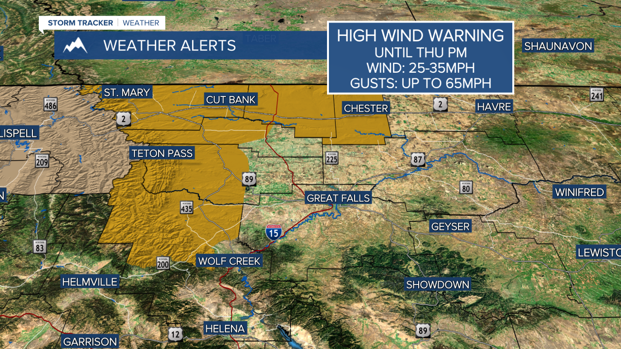
A HIGH WIND WARNING continues for the Rocky Mountain Front, East Glacier area, and out part of the Hi-Line until Thursday evening.
A LAKE WIND ADVISORY continues for Fort Peck Reservoir
That trash can probably will end up somewhere between the neighbor's yard and North Dakota. Strong wind will continue to howl across most of Montana into Thursday along with warm temperatures. The cold front will cross the state Wednesday night into Thursday morning. There will be a few showers and thunderstorms up on the Rocky Mountain Front but this system is predominantly a wind maker. A stray shower is possible Thursday morning north of Great Falls. Thursday will start out windy and partly cloudy with clouds clearing through the day and the wind easing up by late afternoon and evening. Highs will be cooler in the 60s and 70s. Friday will be another warm, late September day with highs rebounding back into the 70s and low 80s. Warm, dry and breezy weather will continue into the final weekend of September. Saturday will be mostly sunny with highs in the 70s and 80s. Another front will move through the state with strong wind and little to no precipitation on Sunday. Highs will be in the 60s and 70s early in the day but fall through the afternoon along with very strong wind. Warm and dry weather will return for the beginning of October next week. There does not appear to be anything cold or snowy anytime soon.
Have a great day,
Curtis Grevenitz
Chief Meteorologist


