


A HIGH WIND WARNING has been issued for the Rocky Mountain Front out across central Montana.
A HIGH WIND WATCH has been issued for parts of north-central Montana.
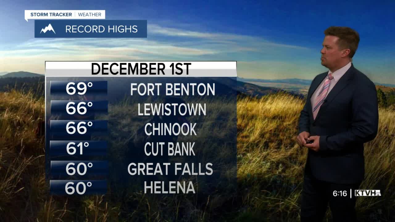
Wednesday is the 1st of December and the beginning of meteorological winter. In the weather world, winter months consist of December - February. However, it will not feel like winter at all. Record highs are likely across a lot of the state, but this warmth will come with wild wind for some towns. Along the Rocky Mountain Front there could be gusts to 100mph! The worst of the wind will occur right along the immediate Rocky Mountain Front, but some gusts could still come close to hurricane strength in parts of central Montana. Unusually warm and windy conditions will happen for the first few days of December, but bigger changes are likely with cold and snow returning by this weekend. Wednesday will be mostly cloudy, very warm and windy for most areas. Valley locations of western Montana will have minor inversions which should limit wind in places like the Helena Valley, Boulder Valley, Blackfoot Valley, and Gallatin Valley etc. Highs will reach the 50s and 60s. A few spots in eastern Montana may even hit 70. Thursday will still be windy and warm with a few records possible. A cold front will slide south through the state on Friday with cooler temperatures and a little snow. This front could stall out across the state on Saturday with an area of low pressure producing some snow, especially up on the Hi-Line. Several inches could fall in some of the lower elevations, with the mountains seeing a good accumulation of several more inches. Sunday should be quiet as the state will be in between storms. Another low pressure with cold air will likely move through later Sunday night into Monday. Overall the entire pattern changes this weekend. Cold temperatures and periods of snow will likely continue into mid-December. Winter is coming, just after a lot of wind and warmth.
Have a great day.
Curtis Grevenitz
Chief Meteorologist
