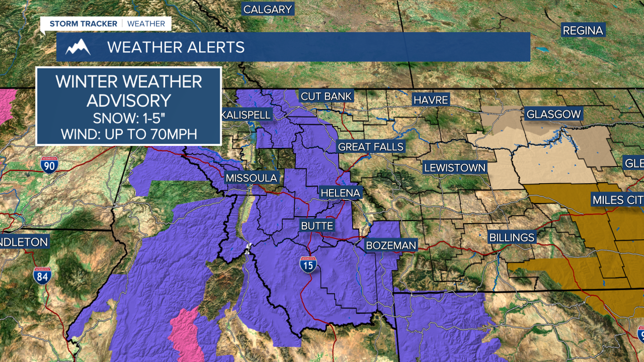
A HIGH WIND WARNING is in effect for most of the state through Tuesday.
A WINTER WEATHER ADVISORY is in effect for the mountains along and west of the Continental Divide.
A FIRE WEATHER WATCH has been issued for parts of northeast Montana.
A major spring storm will bring powerful wind with areas of snow through Tuesday. While accumulating snow will not be widespread, the violent wind sure will be. Sustained wind between 30-50mph is likely for most areas through tonight and Tuesday. Gusts could top out between 70-90mph. The wind will be strong enough to knock down trees and powerlines. Travel will be very difficult, especially over the mountain passes where heavy snow showers with the wind will create blizzard conditions at times. North-central and northeast Montana will also see areas of accumulating snow. Other than that, areas east of the Continental Divide could see a quick burst of snow producing a coating up to a couple inches. Temperatures will only top out in the 30s and 40s. All in all, weather conditions will be severe across most of the state throughout Tuesday. The wind will slowly ramp down through Tuesday night as the storm system moves away from the area. Wednesday will be another windy day albeit a lighter wind. Gusts could still top 50mph, especially over eastern Montana. Some snow will linger for northeast Montana into the morning, with a few rain and snow showers across the central parts of the state. Western Montana including areas around Helena and Great Falls will have mostly sunny skies. Highs will be in the 40s and 50s. The storm will ultimately depart by Thursday with mostly sunny skies, much lighter wind, and highs reaching the 50s to around 60. Friday will be a very nice day with highs in the 60s and 70s. A few isolated thunderstorms are possible late in the evening ahead of the next cold front. Scattered showers and mountain snow will move through during the night. Saturday will be a much colder day with areas of snow, possibly mixed with some rain in the lower elevations. This will start a stretch of potentially prolonged cold and snow that could continue for Sunday, and get heavier and colder by Monday and Tuesday. April is off to quite a stormy start.
Curtis Grevenitz
Chief Meteorologist


