A BLIZZARD WARNING has been issued for the East Glacier area into Saturday morning for blowing snow and whiteout conditions.
A WINTER WEATHER ADVISORY has been issued for the Rocky Mountain Front and the Cut Bank area into Saturday for blowing snow and reduced visibility.
A COLD WEATHER ADVISORY continues for parts of central and southeast Montana through Thursday morning.
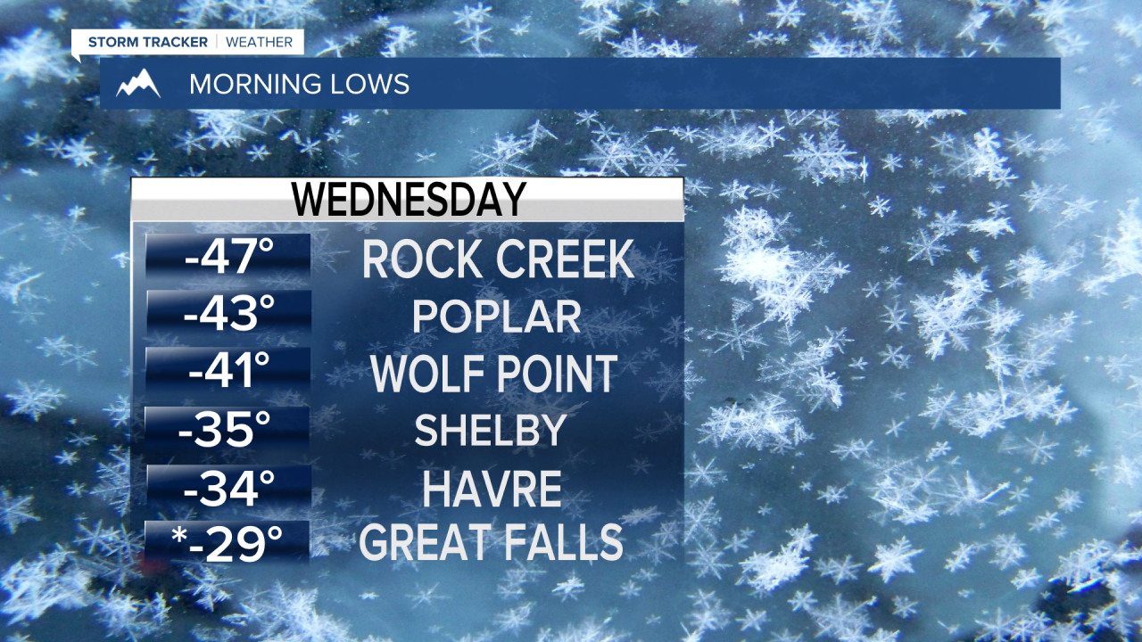
Record breaking cold continued for parts of Montana this morning but warmer air will take over through the next few days. Great Falls, Cut Bank and Havre set record lows on Wednesday morning. Arctic air still has much of northern and eastern Montana in its icy grip, but some places have started to warm. East Glacier was one of the warmer locations in the state on Wednesday afternoon as temperatures popped above freezing. A chinook wind will develop over the next few days pushing out the arctic air but it will create blowing snow issues. Blizzard conditions are possible around East Glacier and down the Rocky Mountain Front and over the Continental Divide. Slightly warmer air will begin to move in on Thursday with highs reaching the 10s and 20s, some 30s near Great Falls and Cut Bank. Skies will be partly cloudy and the wind will increase off the Rocky Mountain Front. Very strong wind will create ground blizzard conditions at times along the Rocky Mountain Front and East Glacier areas through Friday into the weekend. Strong wind around Great Falls and up on the Continental Divide will create blowing and drifting snow as well. Friday will be partly cloudy with highs in the 20s and 30s. The arctic air will be on full retreat heading into the weekend. This final weekend of February will have a thaw as temperatures warm into the 40s to around 50 for highs. A chinook wind will be strong on the plains and Continental Divide. Warmer air is almost here.
Curtis Grevenitz
Chief Meteorologist


