Helena Regional recorded 0.01" of rain yesterday. It's not much but we will take it, considering how dry it has been over the past month. We could add to our total tomorrow with some more light rain showers.
After two straight days of setting record-high minimum temperatures in areas like Great Falls, it is much colder by about 20-30 degrees this morning.
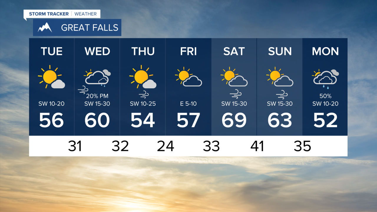
Today will be mostly dry aside from a few remaining snow showers in the Glacier area. Highs will only reach the 50s for most of the state.
More moisture will enter the state tomorrow. Snow and rain across southwest Montana is expected starting tomorrow afternoon, but accumulation will be light and snow will be concentrated to higher elevations above 6000 feet. The heaviest snowfall will be the Beartooth's and Absaroka's, which could receive a few inches.
The remainder of the week will be dry and warming into the 60s by the weekend. A stronger system will come through Montana early next week to give us more widespread rain and snow.
Helena Temperature Records Today:
High: 78 (1915)
Low: 10 (1957)
AVG: 54/31
Great Falls Temperature Records Today:
High: 80 (1915)
Low: 5 (2020)
AVG: 54/30
Have a great Tuesday!
Joey Biancone
Meteorologist
Facebook: Meteorologist Joey Biancone
Instagram: joeybianconewx
Email: joey.biancone@ktvh.com