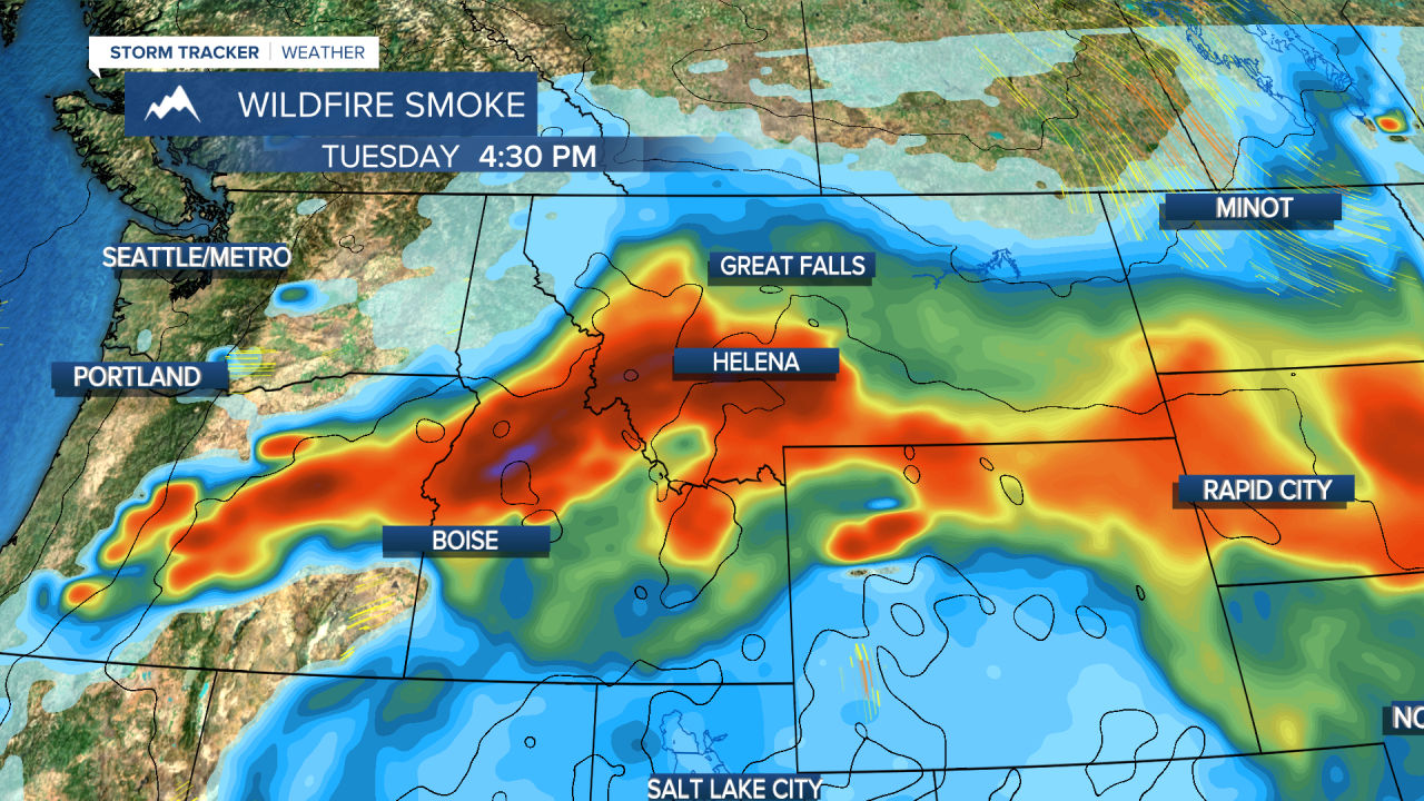
An AIR QUALITY ALERT is in effect for parts of central and western Montana.
Wildfire smoke is having an extreme impact on the air quality across Big Sky Country with a lot of Montana facing unhealthy conditions being outside. This is the worst air quality of this wildfire and summer season. Some places in southwest Montana including the Bitterroot and the Helena Valleys had "very unhealthy" air at times on Monday morning. Hamilton even had "hazardous" air quality. In these conditions, everyone should avoid being outside for long. This is not good weather conditions to hike or run or do things that require physical exertion outside. Recent hot weather allowed wildfires to grow across southwest Montana, Idaho and Oregon. The wind direction is carrying the smoke right across Montana resulting in the poor air. Changes are coming though that will result in better air quality. Tuesday will be cooler with less wind. Highs will be in the 70s to low 80s. The air quality will improve somewhat across northern Montana as the flow switches around to the north. The southern and western parts of the state will continue to have "unhealthy" air at times. A few isolated thunderstorms will pop Tuesday evening. A larger storm will begin moving into the state on Wednesday with mostly cloudy skies and scattered showers and thunderstorms. Highs will be in the 80s east, 70s central and west. Low pressure will move across the state from Wednesday night into Friday. Thursday will be mostly cloudy or overcast with widespread showers, thunderstorms and rain. Highs will be in the 50s and 60s west, 70s east. Rain and mountain snow will fall on most of the state's wildfires. Rain will also fall on Idaho and Oregon fires as well. This along with cooler temperatures will slow the fire activity and thus the smoke output. These conditions will also be more advantageous for firefighters to be more productive in their efforts. Areas of rain will continue Thursday night into Friday. Some locations in western Montana could see between 1-2" of rain! Showers will continue on Friday before the storm moves away. Air quality will improve significantly through Thursday into Friday. Friday will be stronger wind as well with highs in the 60s. This weekend will be partly cloudy with cleaner air and highs in the 70s to around 80. Looking farther down the road, several storms are likely through the end of summer and the end of September. There will be multiple opportunities for rain and snow on the wildfires. Conditions will be improving and fire/smoke season will be getting closer to its end thankfully.
Have a nice day,
Curtis Grevenitz
Chief Meteorologist


