The snow saga continues!
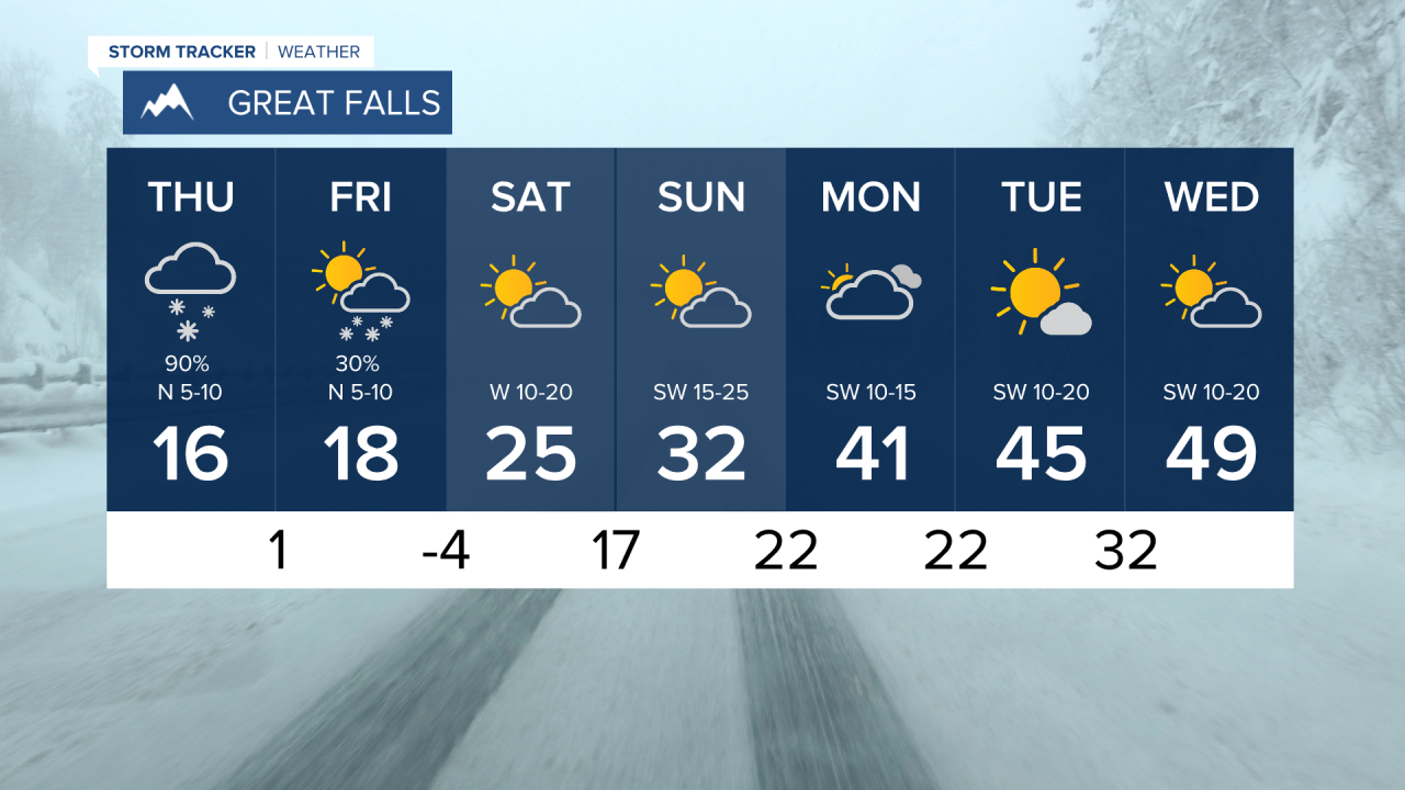
Widespread light to moderate showers track through Montana Thursday morning. It's VERY cold out and will not warm very much today with wind chill values making it feel like the single digits outside. Dress in LOTS of extra layers.
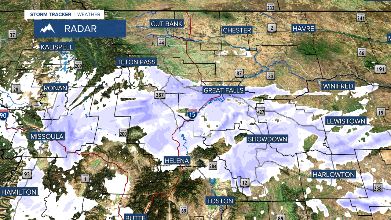
A Winter Storm Warning continues for parts of central and eastern Montana through Thursday around 6PM. This includes Helena. We're tracking further accumulations of 4-9" of snow with limited visibility. Use caution on the roads.
A Winter Weather Advisory has been issued for parts of central and north-central Montana including Great Falls. We're tracking less snow in these areas...more like 1-3" of fresh snow.
These snow showers will start to shift east and dissipate later this evening. But lighter snow flurries will remain through Friday.
Saturday/Sunday conditions will dry out throughout Montana, but very cold temperatures remain. Might be a good weekend to get outdoors and do some sledding...just prepare for the cold! We'll warm back up next week with the help of some high pressure.