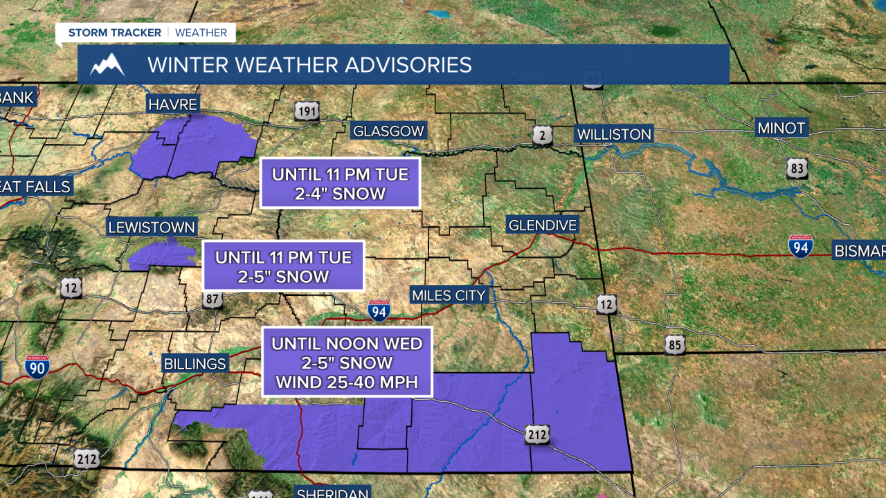
A WINTER WEATHER ADVISORY continues for the Bears Paw Mountains until 11 PM today
A WINTER WEATHER ADVISORY continues for the Snowy Mountains until 11 PM today
A WINTER WEATHER ADVISORY continues for southeast Montana until noon tomorrow
——————————————————————————————————————————
We will see scattered snow showers in the central and eastern plains yet again today. Most of us will be in the upper 30s to low 40s with partly to mostly cloudy skies in western Montana. Snow accumulations can be up to 5 inches in the plains.
Tomorrow, most locations across western Montana will warm into the 40s. I expect to see some snow shower activity around Helena in the morning, but we should mainly experience mostly cloudy conditions.
The end of the work week will be drier and warmer, as a Chinook Wind develops off the Rocky Mountain Front and the western mountains, allowing most places in western Montana to warm into the mid to upper 40s. There's a low chance at this time that some towns in the plains reach the low 50s.
Rain and snow will return to the state this weekend and unsettled conditions will last into early next week.
If you want to check out Helena's weather recap this year, check out this week's weatherwise!
Helena Temperature Records Today:
High: 63 (1939)
Low: -27 (1972)
AVG: 33/15
Great Falls Temperature Records Today:
High: 67 (1939)
Low: -22 (2000)
AVG: 36/17
Have a great Tuesday!
Joey Biancone
Meteorologist
Facebook: Meteorologist Joey Biancone
Instagram: joeybianconewx
Email: joey.biancone@ktvh.com


