A WIND CHILL WARNING continues for most of central and northern Montana into Sunday.
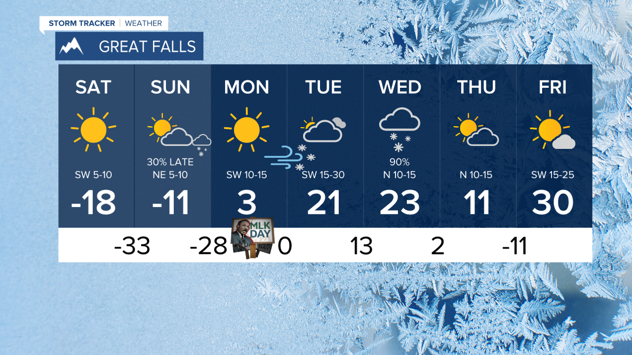
Rock bottom is Saturday morning, after that it will be a slow climb with temperatures warming above 0 hopefully by Monday or Tuesday. Record cold high temperatures and record cold low temperatures will continue into the start of the holiday weekend. In these conditions frost bite could form in minutes. This is about as severe as Montana weather gets. Hunker down, be careful, check on your neighbors, take care of your pets, and make sure to have the winter survival kit in your car if you must travel. The arctic high pressure will move in on Friday night and that's when temperatures will bottom out. Most of the state will have lows of -20 to -45 with wind chills as cold as -60. One change to the forecast is Saturday will be dry and sunny as the arctic high pressure pushes snow farther to the south. Even though Saturday will be sunny, high temperatures will range from 0 to -20. Saturday night will be extremely cold again with lows in the -20 to -40 range. Sunday will be partly cloudy with a few afternoon and evening snow showers, and very cold with little to no wind. Highs will range from -15 to 5 above. A chinook wind should create blowing snow and warming conditions early next week but more snow will develop mid to late next week along with another reinforcing shot of colder air. This next arctic airmass will not be as severe, but temperatures will likely drop below 0 again.
Have a great weekend, stay warm.
Curtis Grevenitz
Chief Meteorologist


