


An EXTREME COLD WARNING continues for northern and eastern Montana through Wednesday morning for wind chills down to -50 to -60.
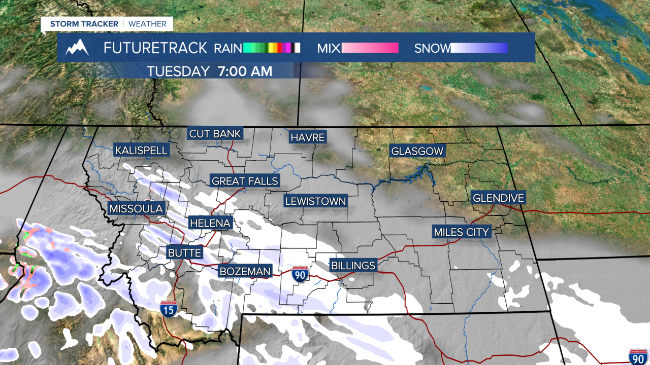
A WINTER STORM WARNING continues into tonight for central and western Montana.
A WINTER WEATHER ADVISORY continues into tonight for parts of north-central Montana.
A COLD WEATHER ADVISORY continues for parts of central and southeast Montana through Wednesday morning.
Brutally cold temperatures continue along with areas of snow, as Montana likely is at the pinnacle of this year's winter. Winter's not over yet, but this is the coldest and snowiest stretch of winter so far. There are signs of a warmup on the way later this week and weekend with highs reaching the 40s and 50s. For now, dangerous cold will continue through the next few days with some areas seeing another few inches of snow tonight. Snow will fly in Helena and Great Falls, out to around Lewistown with up to another few inches by Tuesday morning. Lows will be in the -0s around Helena, but -20 to -40 for areas in northern and eastern Montana. Wind chills could get as cold as -60 in northeast Montana. Some light snow will continue early Tuesday morning before moving to the south. Highs will reach in the 0s around Helena but stay as cold as -15 in central and eastern Montana. Tuesday night the clouds will clear as arctic high pressure settles over the state. East of the Continental Divide, most locations will fall to between -15 to -40. Wind chills will create conditions where frostbite can develop in minutes. Please be careful. Wednesday will start out sunny and cold with clouds advancing through the afternoon. A little light snow is possible across western Montana, reaching as far east as Helena and Great Falls. Highs will still be cold in the -0s to the 10s. Slightly warmer air will begin to move in on Thursday with highs reaching the 10s and 20s. Skies will be partly cloudy and the wind will increase off the Rocky Mountain Front. Friday will be similar with partly cloudy skies and highs in the 20s and 30s. The arctic air will be on full retreat. This final weekend of February will have a thaw as temperatures warm into the 40s to around 50 for highs. A chinook wind will be strong on the plains and Continental Divide. Warmer air is coming...
Curtis Grevenitz
Chief Meteorologist
