A WINTER STORM WARNING is in effect for the Rocky Mountain Front, East and West Glacier into Sunday morning.
A HIGH WIND WARNING continues through Saturday for the East Glacier area, Great Falls area to around Judith Gap.
A WINTER STORM WATCH has been issued for Sunday and Monday for most of central and western Montana including Helena and Great Falls.
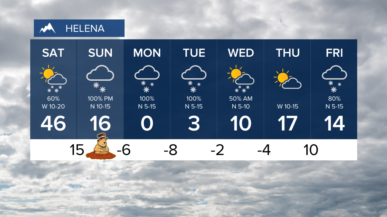
A good, old fashioned Montana snowstorm is about to hit the state as the calendar turns to February. Right now, it's almost a "perfect storm" setup for Montana. Arctic air will come pouring down from Canada and a stalled storm system off the coast of British Columbia will steer an atmospheric river in from the Pacific toward Montana. This pattern could linger for days yielding a significant snow accumulation. February begins Saturday with a new storm. A Pacific cold front will cross the state with a few snow showers and snow squalls, but an arctic front will pass through the state later in the day with tumbling temperatures and areas of light snow. Strong wind will continue across most of the state. Highs Saturday could reach the 40s but lows that night will drop into the -0s and 0s. Sunday and Monday the arctic airmass will settle in with a chance of solid snow developing. Light snow could develop through Sunday and get steadier into Monday. This has the potential for heavy accumulation in the mountains and across the lower elevations. Some snow could continue through Tuesday into Wednesday. More than a foot of snow could fall in some of the lower elevations with a few feet of snow in the mountains. Prepare for this storm now. Again, everything really starts on Groundhog Day Sunday.
Have a great weekend,
Curtis Grevenitz
Chief Meteorologist


