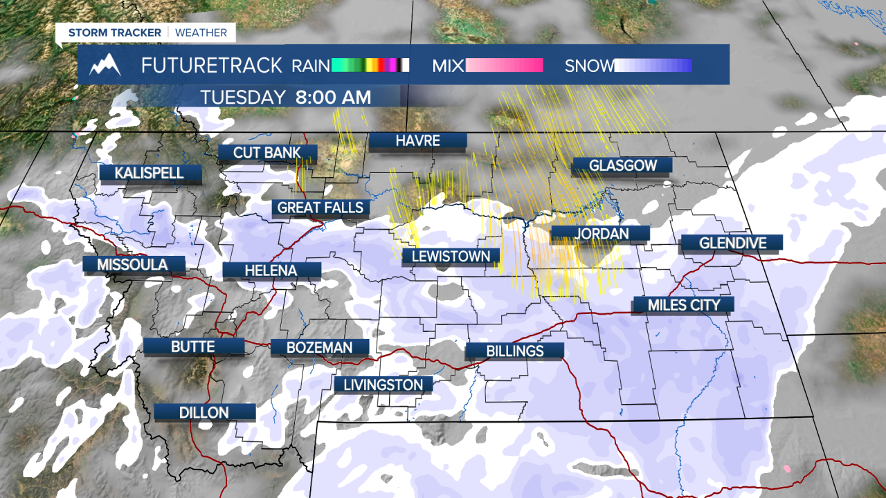
A WINTER STORM WARNING is in effect for the higher elevations of southern Montana through Tuesday evening.
A WINTER WEATHER ADVISORY is in effect for much of central Montana through Tuesday evening.
A new storm is moving into the state with snow and falling temperatures that will really hit for Valentine's Day on Tuesday. A cold front is moving through the state Monday night and an area of low pressure will spread snow across most of the state through Monday morning with the snow diminishing from north to south through the day. Snow will be a little heavier and linger across southern Montana, especially along and south of I-90. It will be a snowy morning for places like Helena and Great Falls, but that snow will come to an end midday with some clearing through the afternoon and sun poking through the clouds. Most locations in the lower elevations can expect a 1-4" snow, but the higher terrain could see upwards of 12" with some of the highest mountain peaks receiving nearly 20". If you have evening plans with your valentine, it will be chilly with most of the snow having ended. Highs will be in the 20s to around 30. Lows will drop down into the 0s and 10s for most of the state. Wednesday will be partly cloudy with highs in the 20s and 30s. The wind will increase across the plains and Continental Divide. Thursday will be a pleasant February day with some of the snow melting as highs reaching the 30s to around 40 under mostly sunny skies. Friday will be partly cloudy, breezy and mild with highs in the 30s and 40s. A weak area of low pressure will produce areas of light snow up along the Hi-Line and Canadian border later in the day. It's Presidents' Day Weekend and the weather will get stormy by the official holiday. A few snow showers will linger for Saturday, otherwise it will be partly to mostly cloudy with highs in the 30s and 40s. The mountains could see a few inches of accumulation. Sunday will be mostly cloudy with some snow in western Montana through the afternoon. Snow will become more widespread on Monday and Monday night. Several inches of snow are likely for most areas through Monday into Tuesday. Next week looks cold and active with periods of snow throughout the week. Winter is not over with yet.
Have a great day.
Curtis Grevenitz
Chief Meteorologist


