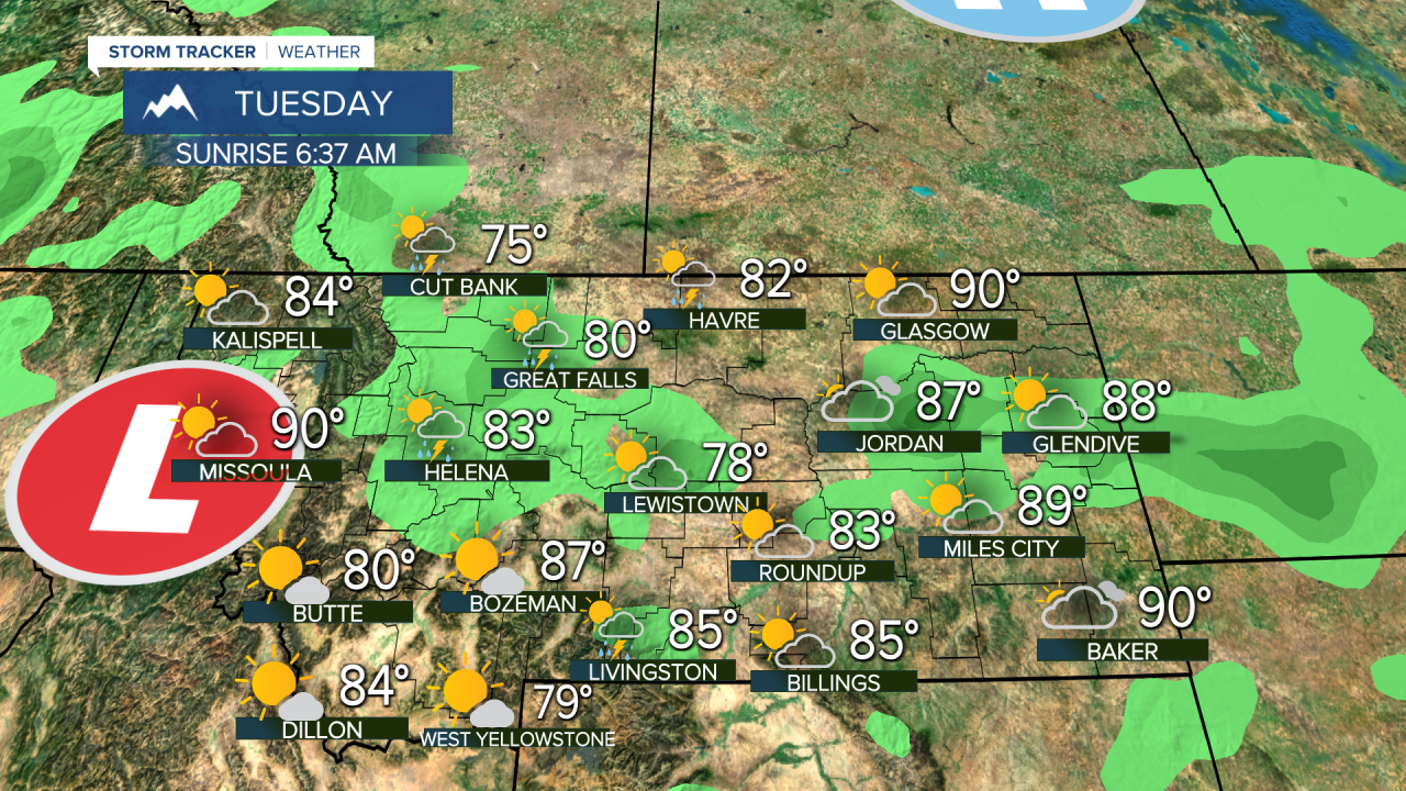
Lightning sparked hoards of new wildfires over the weekend, and the week is off to an electric start as well. New wildfire starts are likely this week keeping firefighters busy. However, mother nature will help out with solid rain and the coolest temperatures in months. An area of low pressure is moving toward western Montana. This low will become nearly stationary over the state for the next several days keeping thunderstorms around (that will spark new wildfires), but also some good moisture and cooler temperatures will slow potential wildfire growth. Not much wind is in the forecast too, which is beneficial. Tuesday will have scattered afternoon and evening thunderstorms across most of the state. Highs will start to cool down with afternoon temps in the 80s. Wednesday will be cloudier, cooler and wetter. Areas of light to moderate rain will move through the state in the morning, followed by some heavy thunderstorm activity in the afternoon. Highs will be in the 70s and low 80s. Thursday could be a very wet, rainy day with mostly cloudy skies for most of the state. There will be thunderstorms too, but the rainfall will be plentiful and widespread. Highs will mainly be in the 70s. Friday will have a little more sunshine with scattered thunderstorms across the state. Highs will be slightly warmer in the 70s and 80s. Saturday, thunderstorms will become more isolated as the low pressure finally starts moving out. Highs will be in the low to mid 80s. Sunday will be mostly sunny and nice with highs near 80, but the afternoon wind could increase to 25mph. Early next week, temperatures will climb again into the 90s with dry conditions returning.
Curtis Grevenitz
Chief Meteorologist


