A WINTER WEATHER ADVISORY continues for the Big Belt, Bridger, and Castle Mountains; Gallatin and Madison County Mountains, and Centennial Mountains until 11 AM Monday
A WINTER WEATHER ADVISORY continues for Little Belt and Highwood Mountains until 11 AM Monday
A WINTER WEATHER ADVISORY continues for Gallatin Valley until 11 AM Monday
A WINTER WEATHER ADVISORY continues for Red Lodge Foothills; Beartooth Foothills until 5 AM Tuesday
A WINTER STORM WATCH has been issued for East Glacier Park Region; Northern High Plains; Eastern Glacier, Western Toole, and Central Pondera; Southern Rocky Mountain Front; Southern High Plains from Tuesday afternoon until Wednesday morning.
——————————————————————————————————————————

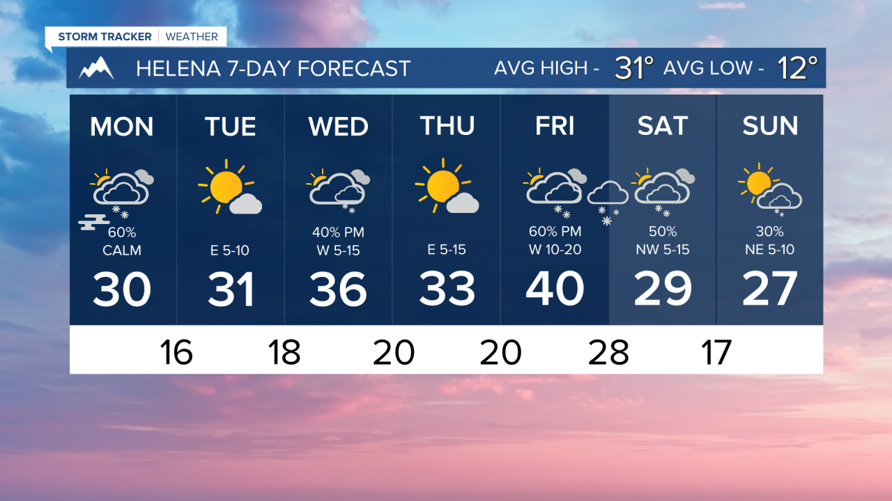
Snow continues this morning for Helena and Great Falls. We will start to see snow showers diminish this afternoon. Highs in the valleys of western Montana will be in the low to mid-30s, while the plains will be in the teens. Some isolated snow showers will move from north to south this evening.
Tomorrow will be a dry day as wind will begin to pick up along the Rocky Mountain Front. Some areas in the plains will be a bit warmer. But most will still only have highs in the teens and 20s. The valleys of western Montana will be similar to Monday's highs.
More light snow will move in Wednesday afternoon/evening. Some lower elevations could see an additional 1-3 inches with this small disturbance.
A more significant storm system moves in yet again for Friday and Saturday. with cold air returning behind it.
Helena Temperature Records Today:
High: 61 (1914)
Low: -32 (2004)
AVG: 31/12
Great Falls Temperature Records Today:
High: 64 (1914)
Low: -26 (1982)
AVG: 35/15
Be safe on the roads!
Joey Biancone
Meteorologist
Facebook: Meteorologist Joey Biancone
Instagram: joeybianconewx
Email: joey.biancone@ktvh.com


