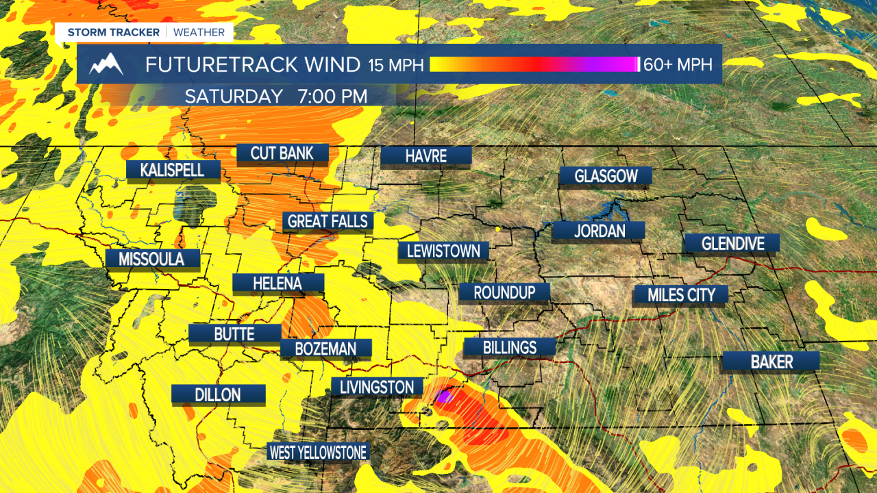
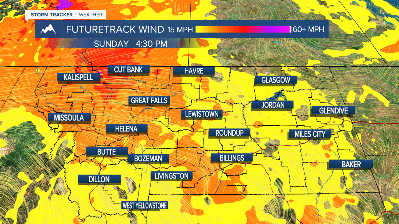
There will be a return of hot temperatures and screaming fire danger this weekend, before a significant storm that could extinguish some of the blazes. We'll need it after this weekend as temperatures and wind will be on the rise. Saturday will be a hot day as highs climb up into the mid and upper 90s, but the wind should still be fairly light out of the west up to 15mph. Sunday is a different story. It will be hot and windy with another big wildfire day likely as wildfires could explode. The combination of hot temperatures and a strong west wind could allow existing fires to grow exponentially once again. Next week, it is likely that another wet and cool storm system will impact much of Montana. While the fire danger will start off high on Monday, many locations could be looking at a repeat of last Sunday's rain and cooler temperatures. Rain and cooler temperatures will sweep across the state through Tuesday into Wednesday. This is likely to be a significant rain with highs on Tuesday only in the 50s, 60s and 70s. Areas of rain will continue through Wednesday. Another cooler airmass and more rain is possible later Thursday into Friday. The rest of August looks much more temperate compared to July. Not to say there won't be any new large fires, but the conditions are not as severe as earlier in the summer.
Have a great weekend!
Curtis Grevenitz
Chief Meteorologist


Posted
and last updated
Copyright 2021 Scripps Media, Inc. All rights reserved. This material may not be published, broadcast, rewritten, or redistributed.


