An AIR QUALITY ALERT continues for the Hi-Line and eastern Montana.
A HEAT ADVISORY continues for north-central Montana and the Helena Valley through 9 PM Thursday.
A HEAT ADVISORY continues for the Flathead/Mission Valleys, West Glacier, Missoula/Bitterroot Valleys and the Potomac/Seeley Lake region through 12 AM tonight.
A HEAT ADVISORY continues for the Lower Clark Fork and Kootenai/Cabinet Regions of Western Montana through 12 AM tonight.
An EXCESSIVE HEAT WARNING continues for eastern and south-central Montana from 9 PM Thursday.
A RED FLAG WARNING continues for the East Glacier region through 9 PM Thursday.
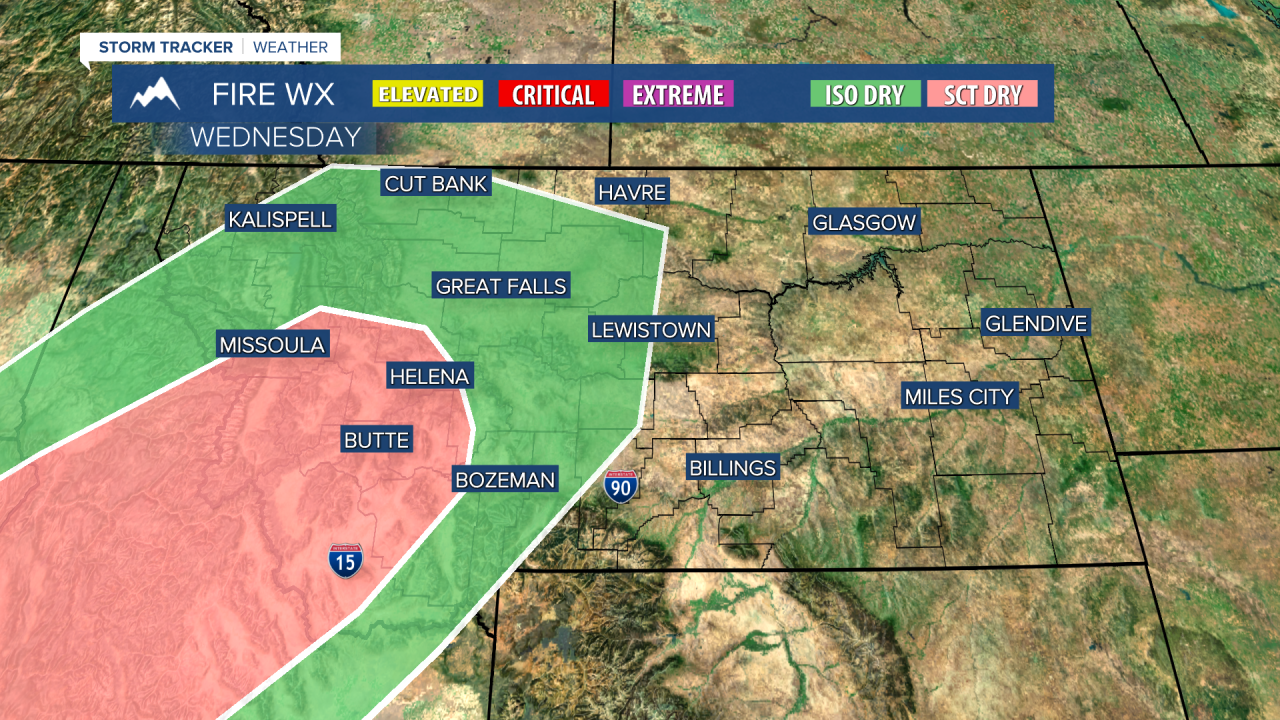
A RED FLAG WARNING continues for southwest Montana through 9 PM tonight.
A FIRE WEATHER WATCH continues for central Montana through midnight Thursday.
——————————————————————————————————————————
Heat, fire, and air quality alerts are in effect for just about every Montana county this morning ahead of what should be a record breaking heatwave. Temperatures will start to decrease tomorrow and into the weekend.
High temperatures, low relative humidity, and strong west winds once again increase the fire danger in the mountains of Montana today. There is also a chance of seeing dry thunderstorms pop over the Idaho/Montana border and move northeastward throughout the afternoon. Lighting strikes from this type of storm can spark wildfires. Not all the storms will be dry.

Record daily high temperatures are possible today, especially in eastern Montana where 110 degree heat is expected. Helena and Great Falls will be at or above the triple digits today as well.
The Last Chance Stampede starts today. It will be very hot today and tomorrow during afternoon events. Be sure to drink plenty of water and take advantage of shaded areas.
Relief from extreme conditions is on the way. A cold front will advance through the state on Thursday and Friday. Behind it will be cooler air dropping temperatures back down to near average for the start of the weekend.

The beginning of next week will be about the same has the weekend, with highs in the upper 80s to low 90s. Extreme heat will return by the end of next workweek.
Helena Temperature Records Today:
High: 100 (1929)
Low: 40 (1918)
AVG: 89/57
Great Falls Temperature Records Today:
High: 102 (1929)
Low: 36 (1918)
AVG: 87/53
Stay safe in the heat!
Joey Biancone
Meteorologist
Facebook: Meteorologist Joey Biancone
Instagram: joeybianconewx
Email: joey.biancone@ktvh.com


