Happy New Year! As we step into 2024, things are starting to feel a lot cooler and dare I say...more wintery outside.
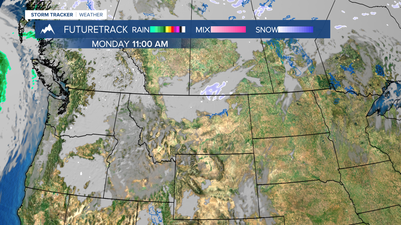
We start out our work week with chilly conditions (feels like temps in the teens and 20s) and high humidity leading to areas of fog this morning in southwestern MT. Be prepared for reduced visibility on the roads.
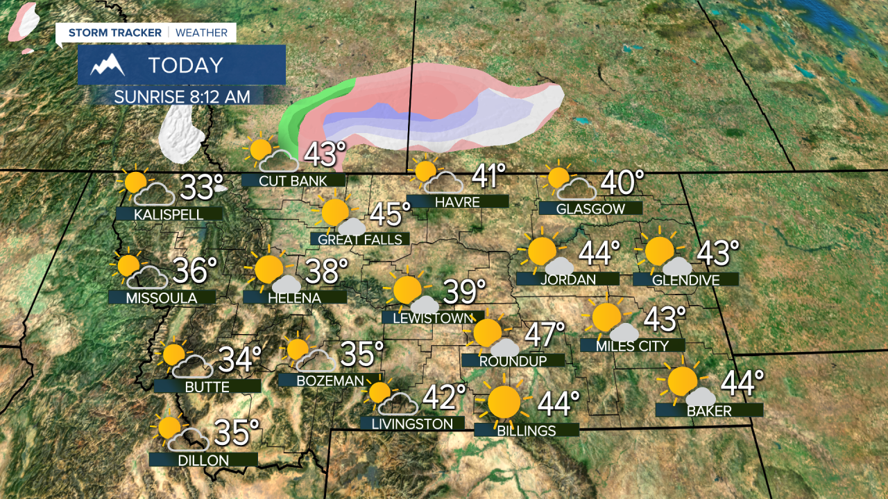
An upper level disturbance is passing through the area bringing some light precipitation towards the north-central region. Freezing rain is a concern and a Winter Weather Advisory has been issued through 10 AM for areas of the Flathead including Polebridge, Essex, Marias Pass, Bad Rock Canyon and HWY 83 Bigfork to Swan Lake.


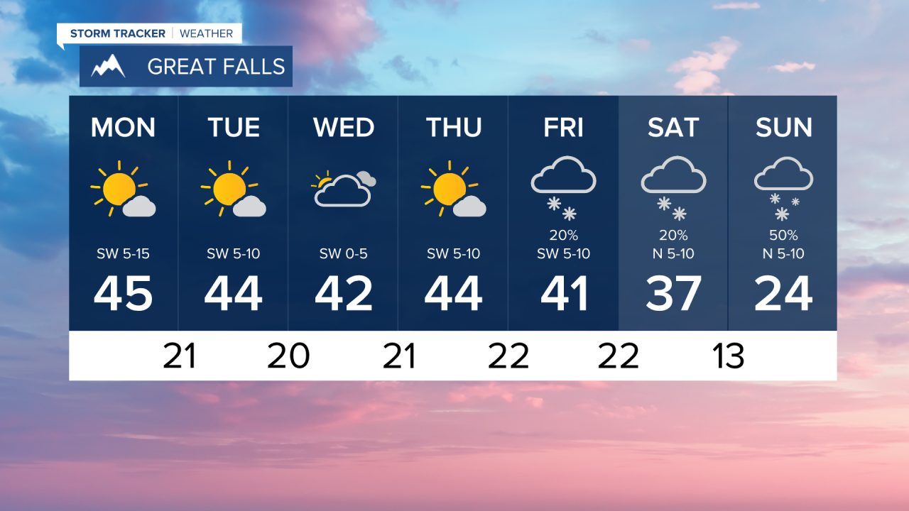
High temperatures this week have generally dropped on the Plains and we're looking at consistent highs in the 40s throughout the workweek - however, these temperatures are still above normal. In the intermountain valleys of western MT high temps are consistent in the 30s - which is a bit closer to seasonable levels.
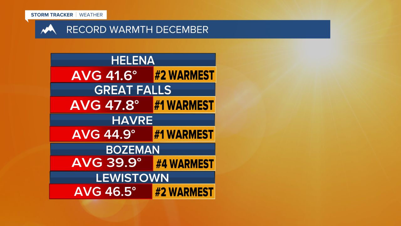
Last month, we had many days with above normal temperatures and here's a few areas that made ranking for overall average warm December temps. As a reminder, we also tracked record dry days in December.

Get excited for SNOW in the forecast!!! Low pressure activity settles in Friday, Saturday and Sunday. At this time, the anticipated accumulation is about 1-3 inches in higher elevations while lower valleys may only see a trace amount. Glacier National Park will be the big hitter with this active weather and could see 5-10 inches.


