A HIGH WIND WARNING is in effect.
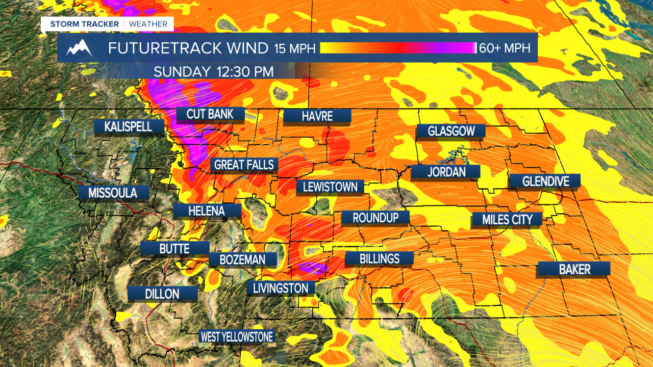
The weekend is coming in howling. A large storm system will pass to the north of Montana, producing very powerful winds to start out the weekend. Wind gusts could reach upwards of hurricane strength in a few areas over north-central Montana and along the Rocky Mountain Front, with gusts to 60mph elsewhere. The jet stream and the storm track will trend to the north of Montana (over the top) for the next several days. This type of pattern usually results in mild and windy conditions with little precipitation, and this should continue through most of next week. Wind will be public enemy #1 for most of the state for days. There is a chance of snow and colder air returning for the second weekend of February. Until then, hold onto your hats and you can probably put the parkas away. Saturday will be very unsettled with strong wind and areas of snow showers scattered across the state. Highs will reach the 30s and 40s. Sunday will be a little calmer with partly cloudy skies and highs in the 30s and 40s. Next week starts out warm with highs in the 40s and the 50s. Each day next week looks mild and windy. There may be some inversions that develop in the western valleys, but either way it will be dry and mild. Toward the end of the week and into the following weekend, some snow and colder air should return.
Have a great weekend!
Curtis Grevenitz
Chief Meteorologist


