A BLIZZARD WARNING continues for Sheridan Country until Wednesday 11am.
A WINTER WEATHER ADVISORY continues for parts of northeast Montana until Wednesday 11am.
A WINTER WEATHER ADVISORY has been issued for East and West Glacier from 11am Wednesday to 11am Thursday.
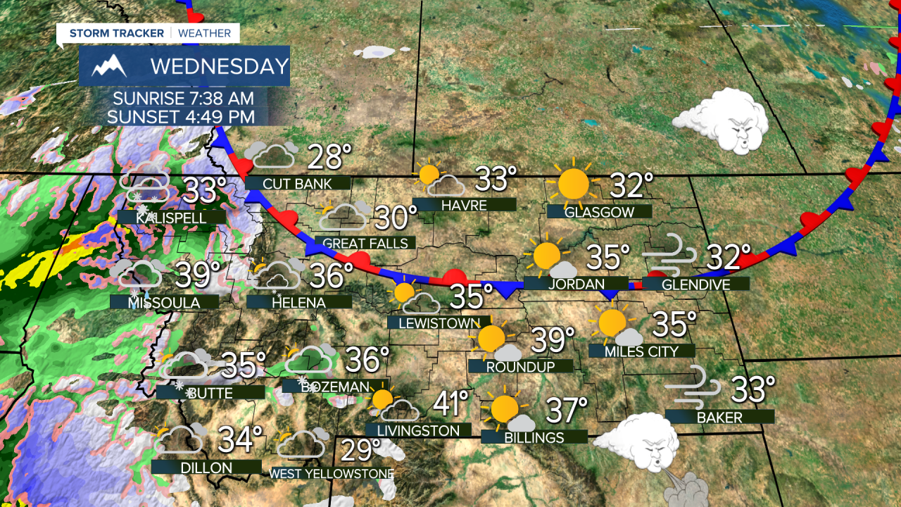
A well developed storm off the coast has its sights set on Montana with several types of precipitation falling in the state across several days. A frontal boundary will set up across Montana where colder Canadian air will clash with warmer Pacific air. This front will meander back and forth across the state for days, with different kinds of precipitation along it. Rain, snow, sleet and freezing rain are possible near and along this boundary. As the boundary shifts, the precipitation type could go back and forth. Areas that see a little freezing rain will get slippery fast, as it only takes a glaze of ice to create treacherous travel conditions. Wednesday, cloudy conditions will develop as the storm gets closer. Temperatures will be in the 20s and 30s for highs. There will be a few snow showers close to the Continental Divide and west of the Divide. Farther west a mix of rain and snow will fall depending on elevation. The storm will get closer to Montana on Thursday, spreading a mix of rain and snow west of the Divide. Areas of light rain, snow and ice will fall just east of the Divide including around Helena and Great Falls. Highs will warm into the 30s and 40s. Friday once again a frontal boundary will play a significant part in the state's weather. Great Falls and northern Montana will fall back into a colder airmass and there will be a little light snow and ice in that part of the state. South of Great Falls, warmer air will persist and any precipitation that falls will be in the form of rain in places like Helena, Townsend, Bounder, Bozeman and Butte. Highs in the northern part of the state will be in the 20s and low 30s. Southern areas will have highs more in the 40s. Saturday morning a cold front will move across the state with widespread snow that should accumulate a few inches. Temperatures will fall into the 20s and 30s. Sunday will be partly to mostly cloudy with a chance of light snow or flurries over southern Montana. Highs will be chilly in the 10s and 20s. Next week is Thanksgiving week, Monday and Tuesday will start out cold and mainly dry but a new storm is possible around Thanksgiving Day with snow. Stay tuned...
Have a great day,
Curtis Grevenitz
Chief Meteorologist


