A FLASH FLOOD WATCH continues for parts of central and southwest Montana through the evening.
An AIR QUALITY ALERT continues for northwest and southeast Montana.
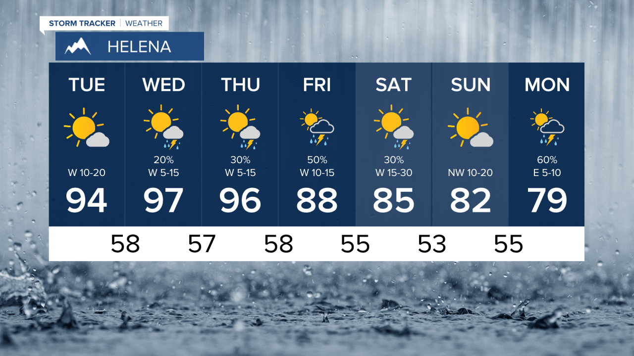
It is a monsoon miracle. Heavy rain continues to fall in parts of Montana. Significant rain has fallen across much of the West over the last few days. Rain has fallen directly over some very large fires in Montana and out of state. The rain could potentially help firefighters get an advantage over some of these fires, and maybe even extinguish some of the flames. BUT fire season is not over with and the state will quickly return to a tinderbox. Strong wind this weekend could be very problematic for firefighting efforts. So for now enjoy the rain, cooler temperatures and clean air. Areas of rain will continue to move through central and southern Montana tonight into Tuesday. The monsoon moisture will affect central and eastern areas on Tuesday, with the western half of Montana drying out and heating up. Highs will be in the 80s and 90s. West wind could gust as high as 20mph. Wednesday will be hot with a few isolated thunderstorms. Highs will be in the 90s for most of the state. Air quality will likely deteriorate as wind blows smoke back in from wildfires across the West. Thursday will be hot with isolated thunderstorms. Highs will again reach the 90s for most of Montana. Friday a cold front will approach the state, kicking off a few thunderstorms. Highs will start cooling down, only reaching the 80s in western Montana, still 90s in eastern Montana. This weekend will be windy and slightly cooler. Highs will be in the 70s and 80s with lows in the 40s and 50s. The mountains will have highs in the 50s and 60s. Although temperatures will be cooler, the wind will make for very high fire danger for much of Montana. The recent rain will only provide a brief pause in the fire danger. It will take prolonged cooler temperatures and more steady precipitation to put an end to this dreadful fire season.
Curtis Grevenitz
Chief Meteorologist


