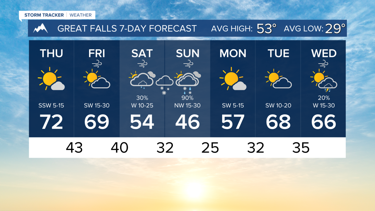
Today is one of the nicest days of the year so far! Highs will reach the upper 60s to low 70s with minimal wind and no precipitation.
Tomorrow will be a similar day, with only a few thunderstorms added to the forecast in western Montana along a cold front Friday afternoon into Friday evening. The state is forecasted to experience temperatures in the upper 60s to even the low 80s, but western Montana will be on the lower end of that range.
There have been some evolutions to this weekend's spring storm. parts of southwest Montana, including Helena, will have a band of moderate to heavy rain set up on Saturday, stretching from Bozeman to about Lewistown. A center of low-pressure forms in north-central Montana during the day. Wrap-around and upslope precipitation develop Saturday night into Sunday morning for the Rocky Mountain Front and Great Falls. Combined with gusty wind, this could make for some blizzard-like conditions for a brief period.
The storm system moves out by Sunday afternoon, with some scattered snow showers remaining in the mountains. High temperatures drop into the 40s and 50s for the entire weekend.
Next week is trending warmer and drier, highs could reach the 60s and 70s once again.
——————————————————————————————————————————
WEATHER ALERTS:
NONE
——————————————————————————————————————————
Helena Temperature Records Today:
High: 78 (2023)
Low: 12 (1929)
AVG: 55/31
Great Falls Temperature Records Today:
High: 78 (2023)
Low: 6 (1935)
AVG: 53/29
Have a great Thursday!
Joey Biancone
Meteorologist