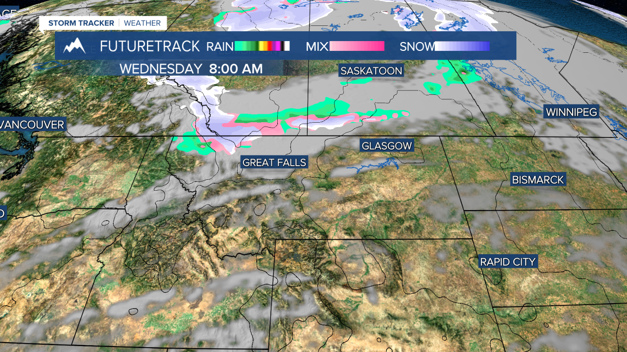
Temperatures are on the rise and will continue to warm through Tuesday, but what goes up must come down. Tuesday will be one of the warmest days of 2025 so far with highs in the 60s and 70s under mostly sunny skies. But temperatures will take a tumble on Wednesday as a cold front will bring a big enough drop in the mercury for rain to mix with and change to snow. Rain will turn to snow across northern Montana in the morning, and southern Montana by the afternoon and evening. Highs will range from the 30s and 40s north, to the 50s south. By Wednesday night, most of the precipitation will be in the form of snow. Snow will continue for mainly the southern half of Montana into Thursday. A few inches of snow are possible in the lower elevations with up to 6" in the mountains by Thursday morning. The storm will slowly move south on Thursday with partly cloudy skies up north, and snow will continue for areas along I-90 into Thursday afternoon. Highs will remain well below average, in the 30s and 40s. Thursday night will be chilly with lows in the 10s and 20s. Good Friday the storm will move out. Skies will be mostly sunny but there will still be a few isolated mountain snow showers. Highs will top out in the 40s to around 50. Easter weekend will start out nice but it will not end that way. Saturday will be mostly sunny with highs in the 50s and 60s. Easter Sunday will be mostly cloudy with scattered showers of rain in the lower elevations and snow in the mountains. Easter egg hunts will have a few rain showers to contend with. Highs will be in the 40s and 50s. A larger storm should bring a mix of rain and snow to the state on Monday and Tuesday. A significant accumulation is likely in the mountains and some accumulation is also likely in the lower elevations. Stay tuned.
Have a great day and enjoy the warmth while it lasts.
Curtis Grevenitz
Chief Meteorologist


