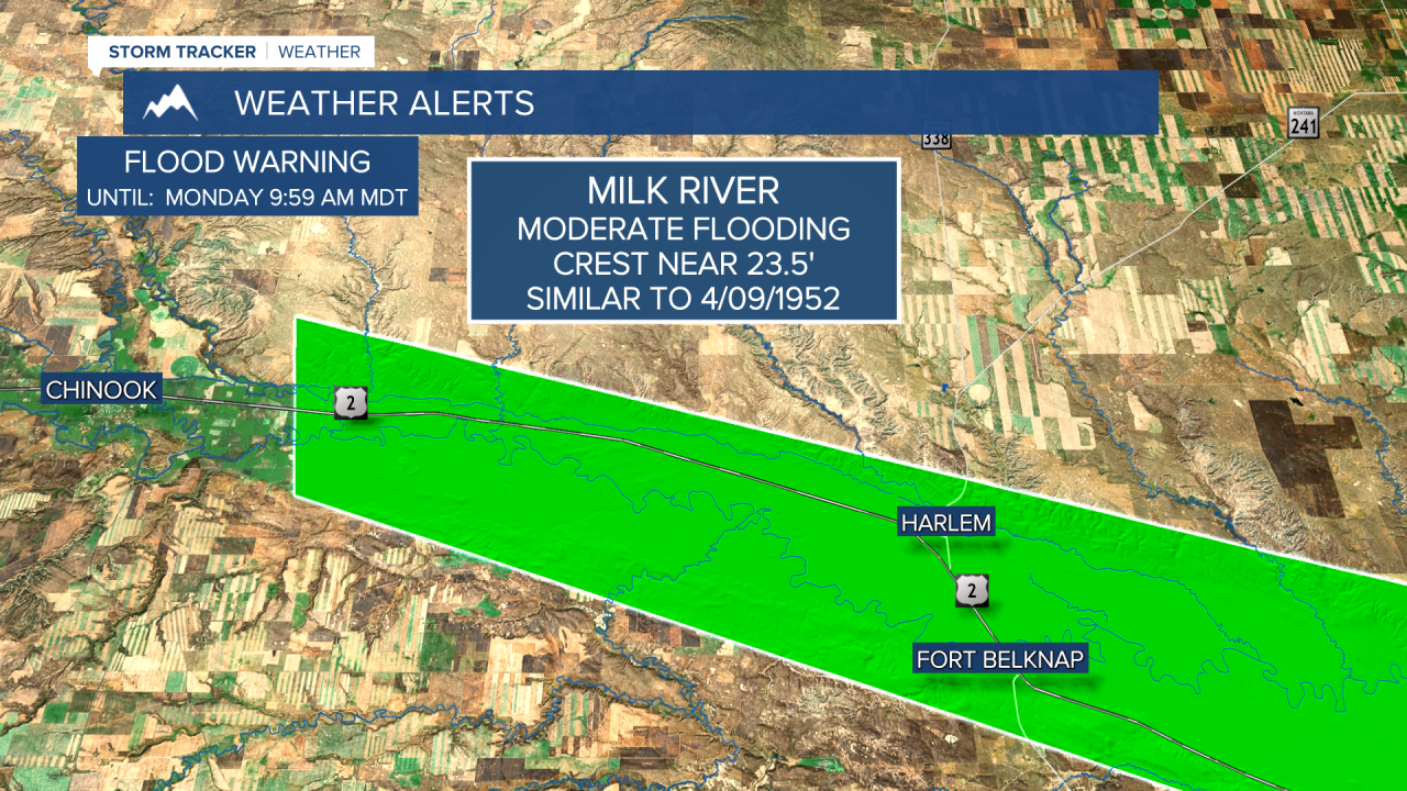
A FLOOD WARNING is in effect for Big Sandy Creek in northern Montana near Havre, for the Milk River near Harlem through Glasgow, and for Beaver Creek near Hinsdale through early next week.
A FLOOD ADVISORY is in effect for much of northern and central Montana.
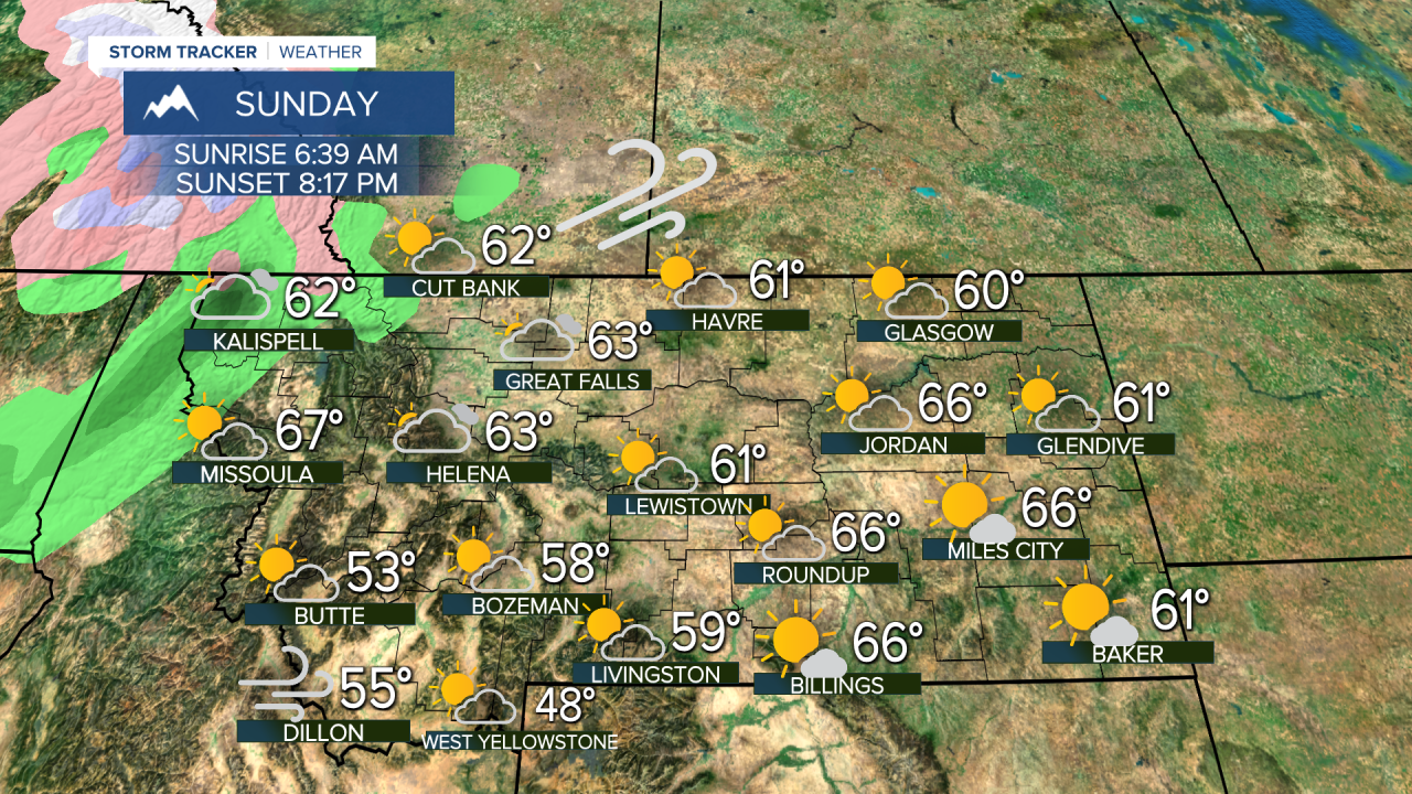
Welcome to the weekend! Montana gets a break from the stormy weather with a lot of sunshine and warming temperatures through Sunday. The recent snow from Thursday's storm will be melting through the weekend, contributing to MAJOR flooding along parts of the Milk River. Other areas that may not be under a flood warning or advisory will still have fast moving water through the creeks and rivers. The ground is saturated and that last storm produced as much as 1" of liquid equivalent. Temperatures will modify back into the 50s and 60s this weekend. Saturday will be mostly sunny and Sunday will be partly to mostly cloudy. Expect water to rise again across creeks and low laying areas. Next week there will be more rain showers and chances for snow. Monday will be a showery day with highs in the 50s and 60s. Tuesday will be cooler, possibly cold enough for a mix of rain and snow in the lower elevations. The higher terrain will have some accumulating snow. Wednesday will be a showery day with scattered rain and snow showers. Thursday will turn cooler with a chance at widespread light snow even in the lower elevations. This wet weather is great for the drought and for upcoming fire season, but it will ensure that areas of flooding continue. The rest of April should have below normal temperatures with above average to near average precipitation.
Curtis Grevenitz
Chief Meteorologist


